Travel Destinations In Kashmir
suhanasafartravels.com offers best deals on tour packages.
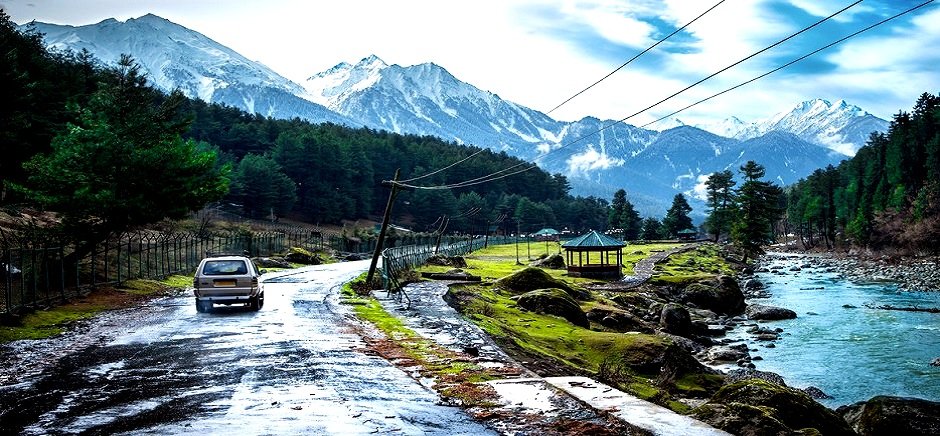
PAHALGAM
Pahalgam is a town and a Municipal committee in Anantnag district in India's northernmost state of jammu and kashmir. It is a popular tourist destination, and every year, many tourists visit Pahalgam. This world famous hill station is 45 km. from the District Head Quarter at Anantnag and located on the banks of Lidder river at an altitude of 7200 ft. from sea level. Pahalgam is one among the five tehsils of Anantnag district and tehsil head quarters are located in the main town of Pahalgam. It was once a tourist attraction and a favourite place for shooting of Bollywood films,and is still a health resort. Besides tourist huts, several hotels in private sector have come up here and these hotels provide modern facilities to their guests. A number of treks in this region also begin from Pahalgam, as the 35 km trail traverses through pinewoods to the spectacular Kolahoi Glacier
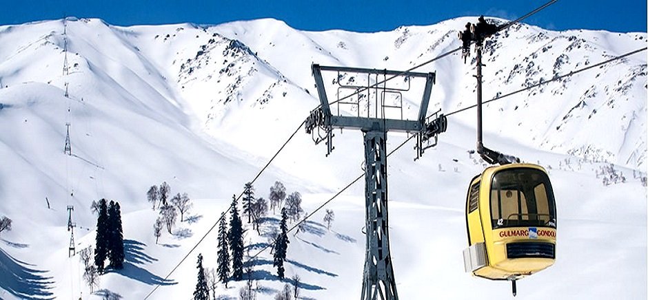
GULMARG
Originally called ‘Gaurimarg’ by shepherds, its present name was given in the 16th century by Sultan Yusuf Shah, who was inspired by the sight of its grassy slopes emblazoned with wild flowers. Gulmarg was a favourite haunt of Emperor Jehangir who once collected 21 different varieties of flowers from here. Today Gulmarg is not merely a mountain resort of exceptional beauty- it also has the highest green golf course in the world, at an altitude of 2,650 m, and is the country’s premier ski resort in the winter. The journey to Gulmarg is half the enchantment of reaching there– roads bordered by rigid avenues of poplar give over to flat expanses of rice fields interspersed with picturesque villages. Depending on the season, nature’s colours could be the translucent green of spring, summer’s rich emerald, or autumn’s golden hues, when scarlet chillies festoon windows of village homes. After Tangmarg, the climb to Gulmarg begins through fir-covered hillsides. At one point, known simply as View Point, travellers generally stop their vehicles for a few minutes and look out a spectacle of snow-covered mountains, almost within touching distance.
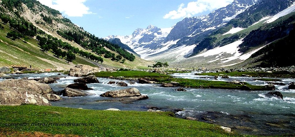
SONMARG
Sonmarg is synonymous with quiet meadows and flower-carpeted fields surrounded by amazing glaciers, miniature plateaus, snowfields, pines and islets. The entire region, 80 km from Srinagar, has some of the highest mountain ranges of the world. These snow clad peaks when reflect the golden rays of the sun, give a sparkling effect to the entire valley. This is the reason why the hill station is named Sonmarg or Sonamarg. The word Sonamarg literally means 'the Meadow of Gold'. The glaciers, waterfalls and placid lakes add some more beauty to this tranquil valley. Situated at an altitude of 2740 m above sea level, at the foot of the Zojila pass, Sonmarg is the gateway to Ladakh. It is a perfect place for the excursionists.
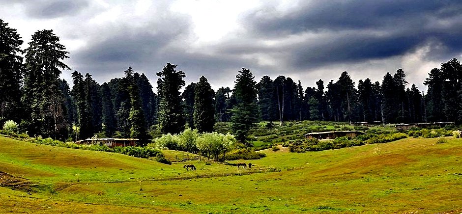
YUSMARG
Yousmarg-a tourist destination of sprawling meadow is 47 kilometers away to the south of srinagar and 13 kms from Chrar-I- sharief town. Yousmarg has the potential to be the gateway to a number of potential destinations in its South, West and East including Doodhpathri, Nilnag, Bargah and Tosamaidan. Yousmarg region has a great tourism potential primarily for the reasons of its virginity and potential for development of ecotourism. There is no historical account of how the region got its name but its believed that yousmarg was called Roosmarg-the meadow of deer-and with passage of time it became yousmarg. The region till some decades ago had abundance of wild life and was famous for the large number of deer that inhabited the region. Yousmarg is a lush green pasture surrounded by forest and snow clad mountains. It is located at a height of 8900ft from main sea level and Doodganga flows in the south making destination further attractive for locals as international tourism.
TULIP GARDEN
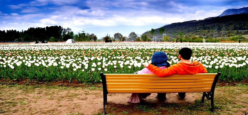
Indira Gandhi Memorial Tulip garden previously named as Model Floriculture Centre, Sirajbagh, Cheshmashahi, Srinagar, is the largest Tulip garden of Asia spread over an area of about 12 hectares. It is situated on the foothills of Zabarwan Range with an overview of picturesque world famous Dal Lake. This garden was conceived, conceptualized and created by Mr. Ghulam Nabi Azad, the then Chief Minister, of Jammu and Kashmir in the year 2006-07 with the aim to boost floriculture and advance tourism in Kashmir Valley.
SHALIMAR BAGH
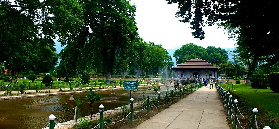
Shalimar Bagh:Built by Emperor Jehangir for his wife Nur Jehan, Shalimar, 15 kms from the Tourists Reception Centre, is a beautiful garden with sweeping vistas over gardens and lakes, and shallow terraces. The garden is 539 m by 182 m and has four terraces, rising one above the other. A canal lined with polished stones and supplied with water from Harwan runs through the middle of the garden. The fourth terrace, by far the best, was once reserved for royal ladies
NISHAT BAGH
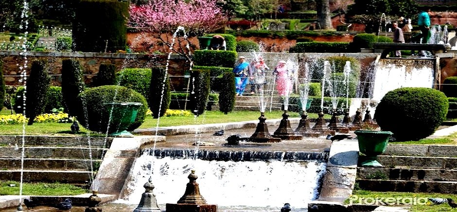
Nishat Bagh: Situated on the banks of the Dal Lake, with the Zabarwan Mountains as its backdrop, (11 km. from Tourists Reception Centre), this 'garden of bliss' commands a magnificent view of the lake and the snow capped Pir Panjal mountain range which stands far away to the west of the valley. Nishat was designed in 1633 AD by Asaf Khan, brother of Nur Jehan.
CHASHME SHAHI
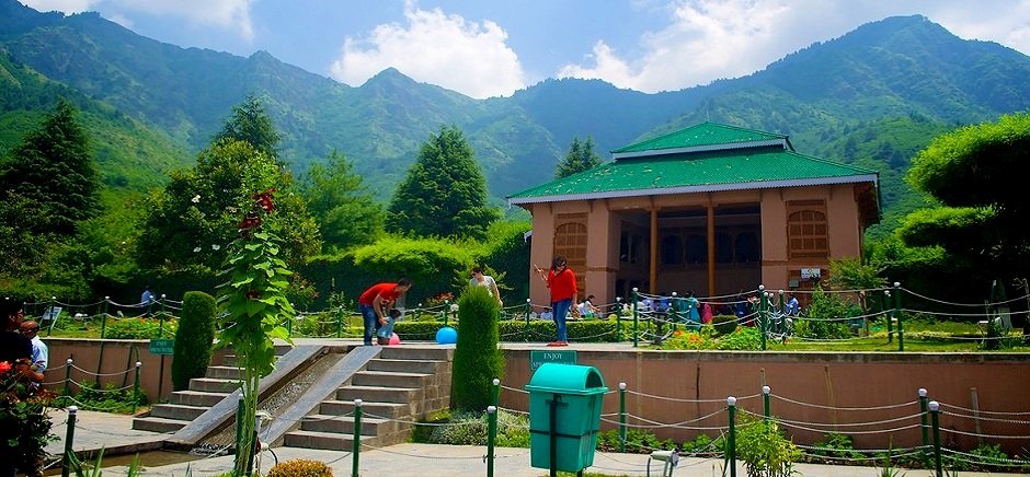
Chashma Shahi: Chashma Shahi has tastefully laid garden in terraces, which commands a magnificent view of the Dal Lake below and surrounding mountain ranges. The cool water of the spring is highly refreshing and digestive. The original garden was laid out by Shah Jehan in 1632 AD. By the side of Chashma Shahi Garden are huts where some of the state government officials have their official residences to enjoy the luxurious stay while serving the Jammu & Kashmir State Government.
PARI MAHAL
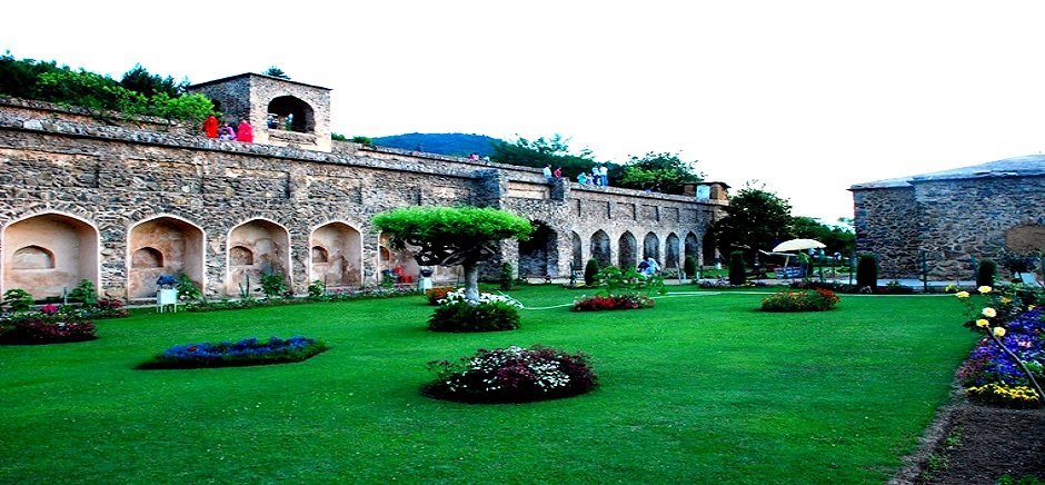
Pari Mahal: Once the royal observatory, Pari Mahal has a charmingly laid out garden and is a five-minute drive from Cheshmashahi. A Buddhist monastery at one time, it was converted into a school of astrology by Dara Shikoh, Mughal Emperor Shah Jehan's eldest son. Situated on the spur of a mountain overlooking the Dal, the ancient monument, with a well-laid spacious garden in front, is connected to Cheshmashahi by road. It is illuminated at night.
DAKSUM
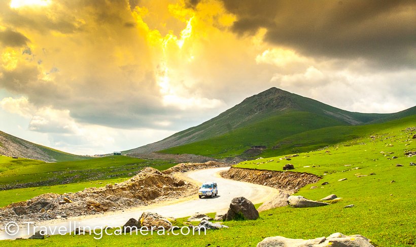
Daksum located in the Green Forests of Jammu and Kashmir at Anantnag-Semthan-Kishtwar road (NH-1B), is a natural scenic spot. However, it is still to be counted in the Tourist Places of JK Tourism Department with Sinthan top. It is located at an altitude of 2,438m above the sea level.Coordinates: 33°36'43"N 75°26'6"E. It is Situated at a distance of 40 km from the main district headquarters and about 85 km from Srinagar. It is on the trekking route to Kishtwar. From here the trail leads to Sinthan Pass also Sinthan top. DAKSUM (8500 ft): A trekker's paradise (2 hours very scenic drive) swathed in coniferous forests, gurgling streams, hidden grassy meadows, where your only company is the sound of the gushing Bringhi river or an occasional shepherd tending his flock. Daksum is also famous for its trout - an angler's heaven. As you drive past the Mughal Gardens of Achabal, you will come across the picturesque Daksum Situated amidst the magnificent grandeur of the Kokarnag springs, it presents an awe-inspiring sight. Standing at an altitude of 2438 m in a densely forested gorge, Daksum offers peace and tranquility. The only sound heard there is that of the Bringhi River, rushing right through its center. Daksum in Kashmir valley is a must for those fond of walking and nature. A walk in Daksum will take you up to the hills enveloped in lush coniferous trees and past gurgling brooks. The simple music coming out of the flute of an unseen shepherd tending to his flock will keep you mesmerized. The landscape of Daksum is quite erratic. From the tree-covered hills, you will suddenly find yourself in grassy meadows serving as host to the sheep coming for pasture. The invigorating mountain air, the calm and serenity, the densely clad hills, all make the trip to Daksum a memorable experience. Then, there are the snow-capped mountains in the background that further enhance the beauty of this place. Hidden from view in a thickly forested area at a height of 2438 Daksum could belong to an era of the Lotus Eaters such is the leisurely calm and peace that pervades the air there but for the gushing of the Bringhi river that runs through it. Daksum is a place where you can revel in solitude and be one with nature. Pine trees; green meadows, clear gurgling brooks, fresh mountain air all promise to make your experience invigorating and long lasting.
ACHABAL
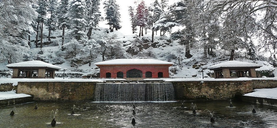
Achabal (Locally known as Achhval) is a town in Anantnag district,India,Jammu & Kashmir. Perhaps the most beautiful of springs is Achabal, which gushes out of the Sosanwar hill, and was once enlisted by the Emperor Jehangir in the service of beauty and pleasure. Achabal is an important tourist place about 7 kilometres away from Anantnag. The place is famous and attractive due to an ancient spring surrounded by a garden terraced and developed by the Mughals. The place has got some historical background also. The upper portion of the garden is called 'Bag-e-Begum Abad' developed by Malika Noor Jehan Begum in 1616 AD and renowned as Sahib Abad in which there is a Hamam (treasure of water) getting heat from a logical lamp (Tosnag). Cascades and fountains erected by Mughal Emperors enhance the beauty of the spot. A mosque standing in the garden believed to have been constructed by Mughal Prince Dara Shikwah. Achabal was once the pleasure retreat of Empress Noor Jehan. A trout hatchery is also located nearby. Achabal is the site of a famous Mughal garden called Achabal Gardens.
NARANAG
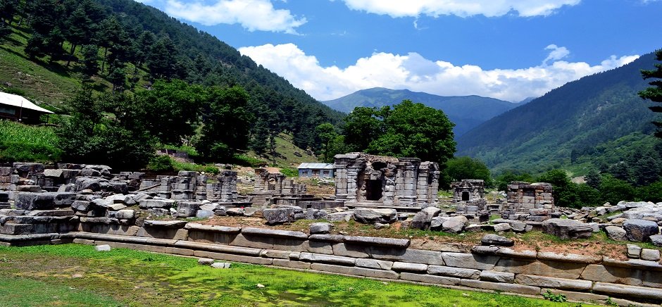
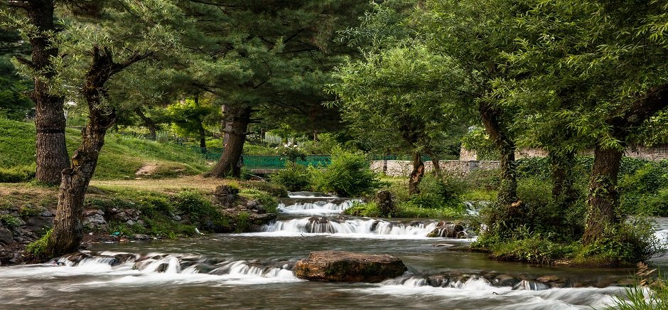
Naranag (or Nara Nag) is a tourist village of Ganderbal district, Jammu and Kashmir, India. It is located around 8 km from Kangan,6 km upstream from the Sind River. Noted for its scenic meadows, lakes and mountains, it is a base camp for trekking to the Mount Haramukh 16,870 ft (5,142 metres) and Gangabal Lake. The village lies at the left bank of the Wangath river, which is a tributary of the Sind River. The Naranag valley is noted for its scenic meadows.The village is a base camp for trekkers to the Mount Haramukh, the Gangabal Lake and Satsar (the seven lakes).It is also a base for the trekkers to Gadsar Lake, the Vishansar Lake and the Krishansar Lake, though it takes 5 to 7 days of trekking. There are also many other peaks and alpine meadows around the Naranag Valley. In the winters, Naranag receives heavy snowfall, during which skiing is practiced. Naranag Temple The Naranag temple is the main attraction for the tourists. It is one of the important archaeological sites of the country.The site consists of a cluster of temples facing each other at a distance of about 200 meters.Historians say that the temple is dedicated to Lord Shiva by the 8th century ruler Lalithdatiya muktadiya. It is believed that the king Awantivarman paid a visit and donated a pedestal for bathing at Bhutsher. Its architecture reveals the art of the 8th century. The government has only constructed walls to protect it from encroachments and nothing else has been done. It is now left in ruins of which only faint traces have survived.This temple has the typical Aryan structure as was present in Aryan Kashmir.
KOKERNAG
Kokernag is a sub-district town and a notified area committee in Breng Valley (The Golden Crown of Kashmir), Anantnag district in the Indian administered state of Jammu & Kashmir. The etymology of the word 'Kokernag' is controversial and there are various theories and none has any conclusive historical proof. As per one such theory Koker means 'fowl' and nag means 'serpent'. The spring gushes out of the base of a thickly wooded hill from where it divides into channels, which resembles to the claw-foot of a hen, hence its name. The other theory is that the word Kokernag originates from Koh (Mountain)kan (from or under)nag (spring). Kokernag is at the height of(approx.)2000 mts from sea level. Place is famous for gardens, largest fresh water springs in Kashmir and for its largest rainbow trout hatchery of north India. Towns and village situated around Kokernag are Bindoo, Zalangam, Bidder, Wangam, Hangalgund,Nagam, Sagam,Duksum, etc. Kokernag has been mentioned in Ain Akbari, where in it has been mentioned that the water of Kokernag satisfies both hunger and thirst and it is also a remedy for indigestion.
VERINAG
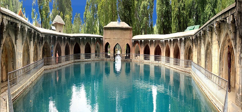
Verinag is a town and a notified area committee in Anantnag district in the state of Jammu & Kashmir, India. It is about 26 kilometers away from Anantnag and approximately 78 kilometeres south-east from Srinagar which is the summer capital of the state of Jammu & Kashmir. Verinag is also the first tourist spot of Kashmir Valley when travelling by road from Jammu, the winter capital of the state of Jammu and Kashmir towards Srinagar, the summer capital of the state of Jammu and Kashmir. It lies at the entry point of Kashmir Valley right after crossing Jawahar Tunnel. A major tourist attraction of this place is Verinag Spring, for which this place is named. There is an octagonal stone basin at Verinag Spring and an arcade surrounding it which were built by Mughal emperor Jahangir in 1620 A.D. Later, a beautiful garden next to this spring, was laid out by his son Shah Jahan. This spring is known to never dry up or overflow. Verinag Spring is also the major source of river Jhelum.Verinag Spring and Mughal Arcade surrounding it is officially recognized by Archaeological Survey of India as a Monument of National Importance.
SINTHAN TOP
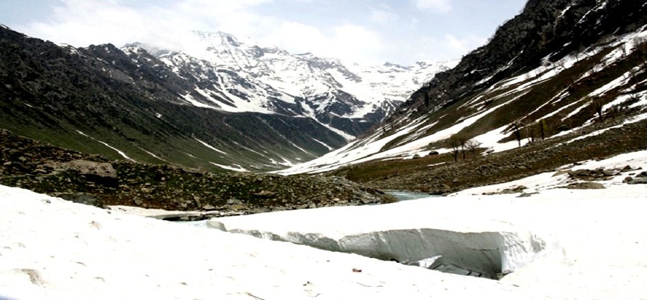
Sinthen top is a hill station, a popular tourist destination located in South Kashmir’s Breng Valley (Sub-District Kokernag) in Anantnag district in the Indian state of Jammu and Kashmir. Like other areas of the valley, Sinthan Top is known for its beauty and wonderful tourist attractions. The place is fast growing as one of the top tourist destination in Kashmir. Around 37 kilometers of snaky and uphill drive from Daksum, it offers an adventurous journey. The spot is emerging for mountaineering, trekking and skiing. Sinthan Top is easily accessible from Srinagar, almost 4–5 hours drive by car. Attractions like Kokernag, Dacksum and Achabal fall en-route that offer tourists varied choice of resting and makes traveling more pleasant and less tiresome. At the spot called '360 Degree View', one can see areas of both Kashmir and Jammu Divisions. Also the spot itself can be a great resting place for people traveling from Srinagar to Kishtwar or Doda and back. Sinthan Top is the South-East end of Breng Valley (The Golden Crown of Kashmir)and is 48 km from famous Kokernag spring. The nearest hotels are located at Kokernag and Daksum ranging from extremely budget accommodation in private and Government huts to deluxe hotels. One should be able to book a night in a hotel or hut between rupess 1500 to 3500. One can plan to visit Lihinwan and the famous Margan Top in the Margan Valley and Inshan which are located in the same area.
DOODHPATHRI
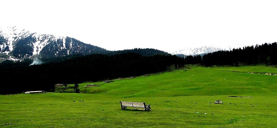
Doodhpathri is a tourist destination and hill station in the Indian Sate of Jammu and Kashmir.It is located in Budgam district of Jammu & Kashmir.Situated at an altitude of 8,957 ft from sea level, and located at a distance of 42 km from state summer capital Srinagar and 22 km from district headquarter Budgam. The name doodpathri means Valley of Milk. It is said that the famous saint of Kashmir Sheikh ul Aalam Sheikh Noor din Noorani has prayed here, and once when he was in search of water in the meadows,to offer prayers, he pricked the ground with his stick to search water, and milk came out, he asked the milk that you can only be used for drinking and not performing ablution.Hearing this milk at once changed its state to water and meadow got its name DOODHPATHRI.The water which is at present flowing through the meadows looks like milk from the distance,and remains very cold throughout the year.The lush green grasses over the vast meadows and silver shinning stream running over the large stones further increase its beauty. Doodhpathri is sloping grassy landscapes with a diversity of multicolored flowers up to Chang. The famous Tosamaidan lies in the west of doodpathri.
BANGUS VALLEY
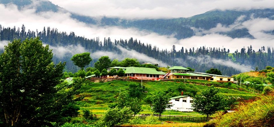
Bangus is one of the relatively unexplored grasslands and unknown tourists paradise situated in the North Western periphery of Tehsil Handwara of District Kupwara, 72 Kms away from Srinagar, summer capital of Jammu and Kashmir (India). The said grass land is at an altitude of about 10,000 ft above sea level. Occupying an estimated area of 300 Sq Kms, Bangus is surrounded by Shamsbery ranges and Leepa valley. Word “Bangus” is derived from Joining two words “ Ban “ derived from Sanskrit word “ Van” meaning “ forest” and “ Gus” meaning “ Grass” ,so it is a meadow with lush growth of wild grass. The Bangus valley has variety of flora, considered ideal for cattle grazing. The area is supposed to have been discovered by an unknown nomad, while grazing his cattle. This is by far the most productive land in this area as it provides a largest niche for producer-consumer relationship. In the summer season numerous cattle and sheep are seen grazing in these meadows which are sent from the adjoining areas by the locals. Bangus valley is surrounded by Chowkibal Mountains on the northern side, Qazinag and Shamsbery Mountains on the western side. Besides other hills also seem to provide protection to the grassland namely; Meeldar, Nastichavan and Yaddil etc. Bangus comprises a mountain biome which includes grassland biome with flora at Lower altitudes and coniferous forests at a higher altitude. An area of 300 sq. Km is proposed to be protected biome under the name of Bangus valley.In the deep valley is a marshy type grass land which is traversed by a small stream popularly known as Tilwan Kohl. Bangus Valley is128 kms from Srinagar via Kupwara, west of Srinagar. This area called Lolab valley One of the most beautiful valleys in the whole state, huge meadow is 6 kms wide and 19 kms long surrounded on all sides by pine forests with a stream flowing through . It was one of the popular valley for British Tourist upto 1947. This valley is also famous for caves of Kala Roos and one can see stone age wall paintings. There is legend that some of the caves go right up to Russia. There are forest rest houses or one can stay in tents.